Revolutionizing Disaster Mapping: Soarscape’s 3D Intelligence in Action
Advanced Aerial Technologies for Smarter Disaster Response
Soarscape Technologies Co., Ltd. leads the frontier of aerial intelligence and 3D modeling, offering cutting-edge solutions that empower first responders, urban planners, and emergency agencies. Headquartered in China and serving global markets, the company specializes in integrating unmanned aerial systems with high-performance data analytics for real-time disaster response and recovery.
As Indonesia faces recurring natural hazards—earthquakes, floods, and volcanic eruptions—there’s an urgent need for fast, accurate, and reliable geospatial data. Soarscape’s technology suite addresses this need through innovative hardware and software solutions that transform complex terrains into actionable intelligence, even under the most unpredictable field conditions.
Smart Mapping Systems That Empower Emergency Decisions
Soarscape delivers a comprehensive ecosystem of tools designed for high-precision, real-time disaster mapping and modeling. Their portfolio includes:
-
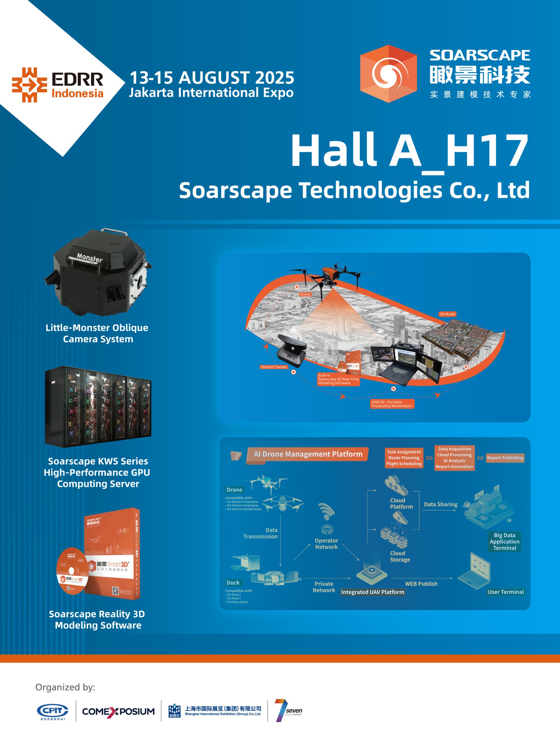
Tiki3D Reality 3D Modeling Software – This software creates highly accurate 3D reconstruction models from aerial imagery, enabling planners and responders to visualize disaster zones, assess damage, and simulate recovery scenarios with stunning clarity.
-
“LoneHawk” Real-Time Mobile Modeling System – A field-deployable solution, LoneHawk provides on-site, real-time 3D modeling without requiring back-end processing. It’s particularly useful in remote or rapidly changing environments where fast situational awareness is vital.
-
Intelligent Drone Management System – Through smart fleet coordination and automated flight planning, Soarscape enhances aerial survey efficiency while minimizing operational risk. This ensures optimal data coverage in time-sensitive missions.
-
TWS High-Performance GPU Cluster Computing Hardware – This computing powerhouse accelerates large-scale image processing, allowing faster generation of high-resolution models and maps. It is essential for emergency teams working against the clock.
-
“Little Monster” Aerial Oblique Camera System – Equipped with multi-angle lenses, this camera captures rich oblique imagery, enhancing the detail and depth of aerial surveys—especially beneficial in urban disaster zones or collapsed infrastructure areas.
Through seamless integration of these technologies, Soarscape enables agencies in disaster-prone regions like Indonesia to respond with greater accuracy and speed.
Meet Soarscape at EDRR Indonesia

Meet Soarscape Technologies Co., Ltd. (Hall A, booth H17) at EDRR Indonesia
Soarscape Technologies Co., Ltd. invites importers, public sector leaders, and manufacturers to explore collaborations at EDRR Indonesia. Together, let’s build a safer, more resilient Indonesia.
Visit EDDR Indonesia 2025 to discover their live solutions, explore partnership opportunities, and learn how they support faster, cleaner disaster recovery nationwide.